TOPOGRAPHY OF LIBYA.
Tripolitania
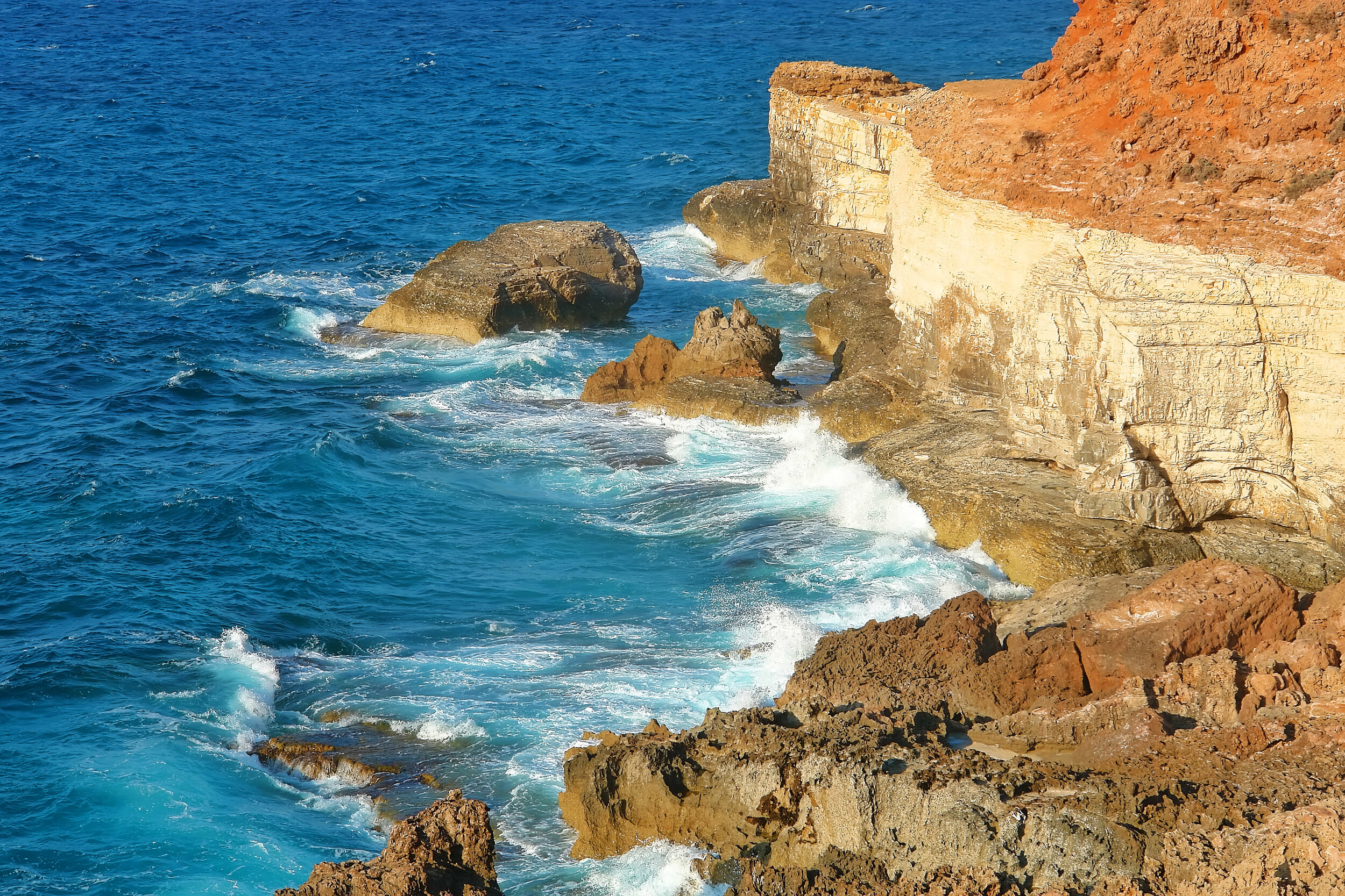
The region of Tripolitania in the Northwest of Libya spans approximately 353,000 km² and is bordered by Tunisia in the West, Cyrenaica in the East, and Fezzan to the South. The North of Cyrenaica is formed of 300km of Mediterrannean shoreline, and is home to a number of coastal oases, interspaced by lagoons and sandy areas. 1.

Mediterranean Coast, Tukrah, Libya
AL-JIFARA PLAINS & NAFUSAH MOUNTAINS
Inland from these areas are a series of gradually elevating coastal steppes, known as the Al-Jifara Plain, which covers roughly 26,000 km2 of the northwestern region of Libya. The greyish brown soil found in this area, makes this a fertile and productive agricultural region. The steppes of the Al-Jafara Plain terminate some 120km to the south, in an escarpment leading to the Nafusa Plateau, which is also an area of fertile soil and home to agriculture. The Nafusa Plateau rises to form the Nafusa Mountains; this limestone mountain range stretches for 340km reaching elevations of up to 1000m2.
Nafusa Mountains, Yefren, Northwestern Libya.
THE SIRTE REGION
The Sirte Region, which is situated along the Gulf of Sidra, is a barren area of land which connects to the Sahara desert and separates Tripolitania and Cyrenaica. The city of Sirte is situated on the coastline, south of the Gulf of Sidra, between Tripoli and Benghazi. The region has a band of coastal oases: Sahabi, Awjila, Jalo, Jaghbub and the salt lake of Sabkhat Ghuzayyil, which measuring 47m below sea level, makes it the lowest point in Libya3. The Sirte Desert is also home to vast plains, sand seas and escarpments.

Farm in Awjila, Coastal Oasis in Sirte Region
Wikipedia Commons
CYRENAICA
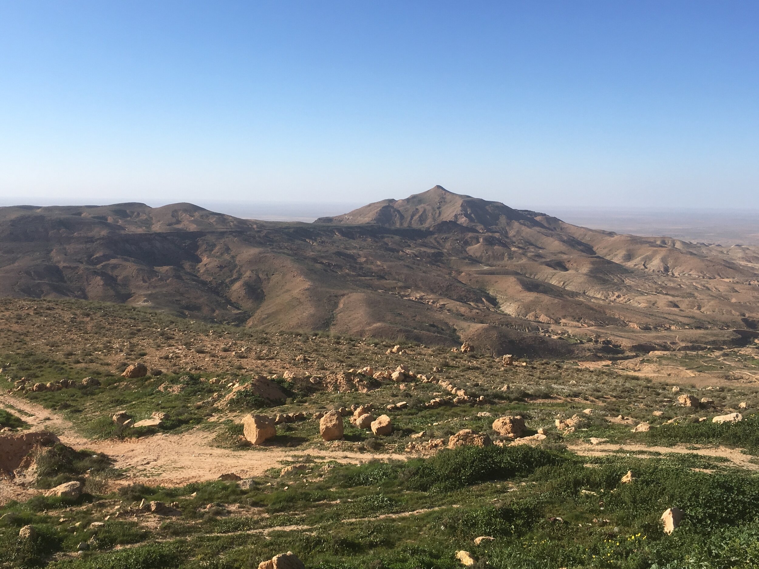
The borders of Cyrenaica run east from the region of Tripolitania and south from the Mediterrannean sea to the borders of Chad and Sudan and spans approximately 855,370 km²4. Cyrenaica is home to three major Libyan cities, Benghazi, Al-Bayda and Derna. These cities form a 210km wide crescent across the lowlands of Cyrenaica. The area beyond sees the start of the Jebel Akhdar Mountain region, also known as the Green Mountains5.

Derna Valley.
Public domain, via Wikimedia Commons. https://upload.wikimedia.org/wikipedia/commons/4/48/Derna_Valley.jpg"></a>
JEBEL AL AKHDAR (GREEN MOUNTAINS)
The Jebel Akhdar is composed of a mountainous, limestone plateau, interspersed by valleys and wadis and spans from Benghazi in the West and extends past the city of Derna, occupying approximately 330 kms of Libya’s coastline. The Jebel Akhdar is the wettest region of Libya, and receives approximately 600 mms of precipitation each year6. While the terrain is primarily forested, sections of the Jebel Akhdar are used for agriculture, with fruit, potatoes and cereals being grown across these regions7. Animal husbandry is also practised in the region, and dromedaries, goats and sheep are raised and herded in the Jebel Akhdar region8.

Jebel Al Akhdar (Green Mountains)
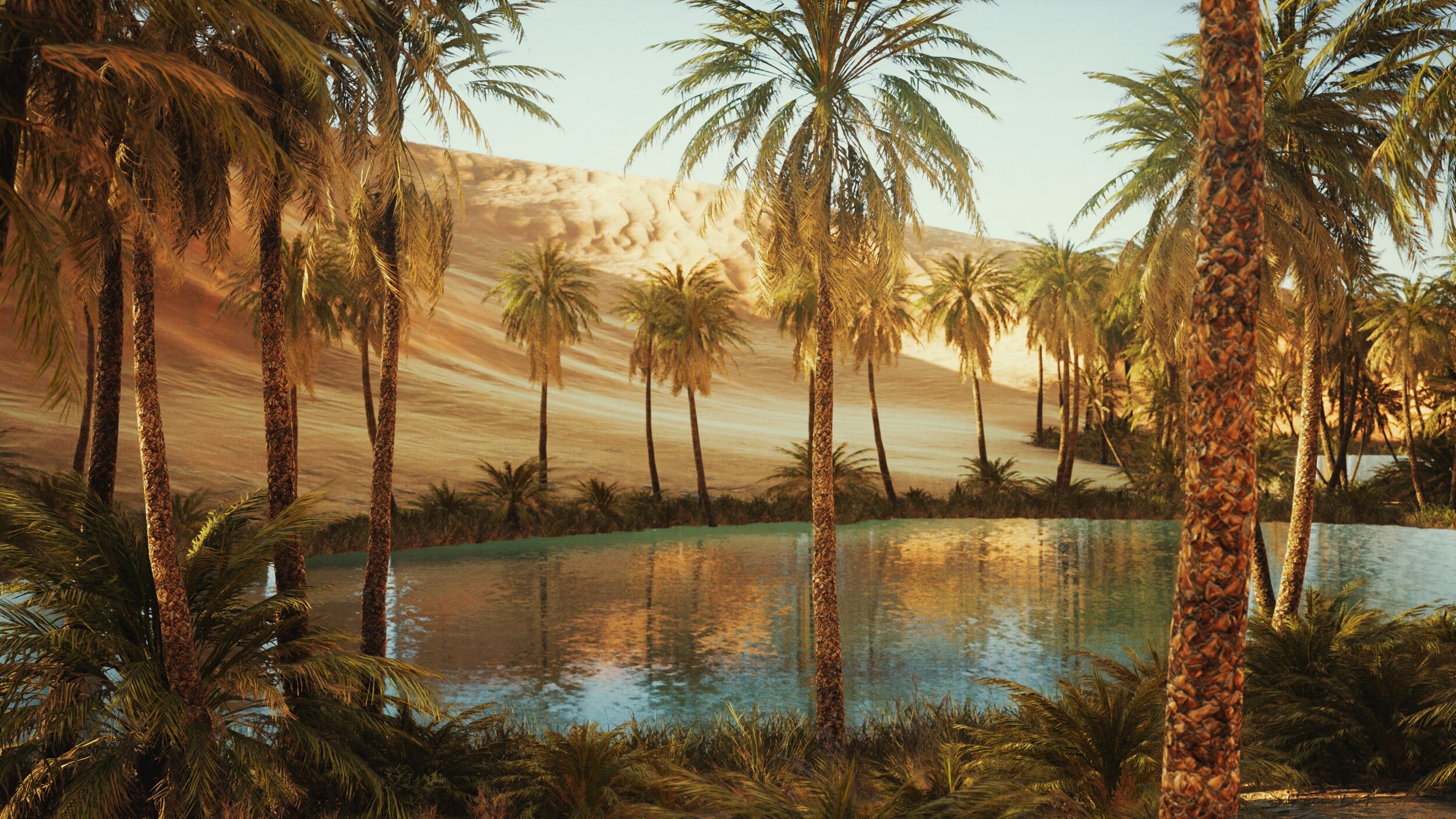
Ubari Oasis, Fezzan
FEZZAN
Fezzan is primarily a desert region, spanning approximately 551,170 km², situated in the Southwest of Libya9. It borders Niger and Chad to the South and Algeria to the West. Fezzan is home to numerous widely dispersed desert oases, the largest of which are the Murzuq Oasis, on which the city of Murzuq was established, and the Gaberoun Oasis, on which the Fezzan capital of Sabha is situated, both of which lie in the southwest of the region. Along the southern and southwestern borders, the land rises toward the Ahaggar Plateau and the Tibesti Mountain range10.

Ubari Oasis, Fezzan
FOOTNOTES.
Abdel Aziz Tarih Sharaf, "Jughrafia Libia", Munsha’at al Ma’arif, Alexandria, 2nd ed., 1971, pp. 232-233.
Barich, Barbara E.; Garcea, Elena A.A.; Giraudi, Carlo (2015). "Between the Mediterranean and the Sahara: geoarchaeological reconnaissance in the Jebel Gharbi, Libya". Antiquity. 80 (309): 567–582.
Geography of Libya.” .com, August 31, 2020. https://fanack.com/libya/geography/.
Abdel Aziz Tarih Sharaf, "Jughrafia LiFanackbia", Munsha'at al Ma'arif, Alexandria, 2nd ed., 1971, pp.232-233.
Geography of Libya.” Fanack.com, August 31, 2020. https://fanack.com/libya/geography/.
“Akhḍar Mountains.” Encyclopædia Britannica. Encyclopædia Britannica, inc. Accessed January 12, 2021. https://www.britannica.com/place/Akhdar-Mountains.
"Cyrenaica at 1300m". Hidden Journeys. Retrieved 27 November 2016.http://www.hiddenjourneys.co.uk/London-Dar-Es-Salaam/Cyrenaica/Highest.aspx
Benzabih, Hosney A. (1982). "The Jabal Al Akhdar: A Half Century of Nomadic Livelihood". In Joffe, E. G. H.; Malachlon, K. S. (eds.). Social and Economic Development of Libya. Wisbech, Cambridgeshire, England: Menas Press. pp. 195–206.
Abdel Aziz Tarih Sharaf, "Jughrafia Libia", Munsha’at al Ma’arif, Alexandria, 2nd ed., 1971, pp.232–233.
"Encyclopedia of the Modern Middle East and North Africa. Encyclopedia.com. 22 Dec. 2020. https://www.encyclopedia.com/places/africa/libyan-political-geography/fezzan.